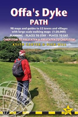
The Offa's Dyke Path is a superb national trail that runs from the North Wales coast to the Severn Estuary following the line of Offa's Dyke, an impressive 8th century earthwork along the English/Welsh border. The ever-changing landscape – the Clwydian Range, the Shropshire Hills, the Black Mountains and the Wye Valley – is steeped in history and legend providing 177 miles of fascinating walking.
This is an all-in-one two-way hiking route guide, maps and accommodations for the 177-mile Offa's Dyke Path in Wales, which runs along the border with England. Includes 87 large-scale walking maps (3 1/8 inches to 1 mile); 11 town maps and 15 overview maps. Full details of all accommodations and campsites, restaurants and pubs; plus full public transport information. Includes day-walks.
- Two-way guide - walk from north to south (Prestatyn to Chepstow) or south to north (Chepstow to Prestatyn)
- 11 town plans and 87 large-scale walking maps – at just under 1:20,000 – showing route times, places to stay, points of interest and much more
- Plus 14 overview maps Itineraries for all walkers – whether walking the route in its entirety over seven to eight days or sampling the highlights on day walks and short breaks
- Practical information for all budgets – camping, bunkhouses, hostels, B&Bs, pubs and hotels – where to stay, where to eat, what to see, plus detailed street plans
- Comprehensive public transport information – for all access points on the path.
- Flora and fauna – four page flower guide, plus an illustrated section on local wildlife
- Green hiking – understanding the local environment and minimizing our impact on it
- With downloadable gps waypoints now also with what3words references
- Includes extra colour sections: 16pp colour introduction and 16pp of colour mapping for stage sections (one stage per page) with trail profiles.
Inhaltsverzeichnis
INTRODUCTION History 9 – How difficult is the Offa's Dyke Path? 11 How long do you need? 13 – When to go 14 PART 1: PLANNING YOUR WALK Practical information for the walker Route-finding 17 – GPS 18 – Accommodation 19 – Food/drink 22 Money 25 – Walking companies 25 – Annual events 27 – Information for foreign visitors 28 – Walking with a dog 29 – Disabled access 30 Budgeting 30 Itineraries Which direction? 31 – Village & towns facilities table 32 The best day and weekend walks 35 – Suggested itineraries 37 What to take Luggage 38 – Footwear 39 – Clothes 40 – Toiletries 41 – First-aid kit 41 – General items 41 – Camping gear 42 – Money 42 – Maps 43 Sources of further information 44 – Recommended reading 45 Getting to and from the Offa's Dyke Path Getting to Britain 47 – National transport 48 – Local transport 48 Public transport services 49 – Public transport map 52 PART 2: HISTORY, ENVIRONMENT & NATURE Historical background (by Colin Vickerman) 54 Conserving the Anglo-Welsh Border Country 59 Flora and fauna 62 PART 3: MINIMUM IMPACT & SAFETY Minimum-impact walking 75 Health and outdoor safety 80 PART 4: ROUTE GUIDE AND MAPS Using this guide 83 = walking north = walking south Sedbury Cliffs to Chepstow 85 (Chepstow 85) Chepstow to Sedbury Cliffs 90 Chepstow to Monmouth 90 (Tintern 94, Brockweir 98, Bigsweir 98, St Briavels 98, Redbrook 102, Monmouth 102) Monmouth to Chepstow 106 Monmouth to Llantilio-Crossenny 106 (The Hendre 107) Llantilio-Crossenny to Monmouth 113 Llantilio-Crossenny to Pandy 114 (Llangattock-Lingoed 115, Pandy 118) Pandy to Llantilio-Crossenny 119 Pandy to Hay-on-Wye 120 (Longtown 122, Llanthony 125, Capel-y-ffin 127, Hay-on-Wye 132, Clyro 136) Hay-on-Wye to Pandy 137 Hay-on-Wye to Kington 137 (Newchurch 140, Gladestry 143, Kington 143) Kington to Hay-on-Wye 148 Kington to Knighton 149 (Discoed 154, Presteigne 156, Knighton 156) Knighton to Kington 159 Knighton to Brompton Crossroads 160 (Clun 164, Newcastle-on-Clun 164, Bishop's Castle 165, Brompton Crossroads 171) Brompton Crossroads to Knighton 171 Brompton Crossroads to Buttington (for Welshpool) 172 (Montgomery 174, Kingswood 175, Welshpool 180, Buttington 185) Buttington (for Welshpool) to Brompton Crossroads 185 Buttington (for Welshpool) to Llanymynech 186 (Pool Quay 187, Four Crosses 190, Llanymynech 190) Llanymynech to Buttington (for Welshpool) 192 Llanymynech to Racecourse Common 192 (Trefonen 195) Racecourse Common to Llanymynech 195 Racecourse Common to Castle Mill 198 (Around Baker's Hill 198, Oswestry 198, Bron-y-Garth 201) Castle Mill to Racecourse Common 201 Castle Mill to Dinas Bran (and Llangollen) 201 (Chirk 203, Around Irish Bridge 204, Froncysyllte 204, Trevor 204, Llangollen 209) Dinas Bran (and Llangollen) to Castle Mill 213 Dinas Bran (and Llangollen) to Llandegla 213 (Llandegla 218) Llandegla to Dinas Bran (and Llangollen) 218 Llandegla to Clwyd Gate 218 (Llanarmon-yn-lal 219) Clwyd Gate (for Llanferres) to Llandegla 223 Clwyd Gate (for Llanferres) to Bodfari 223 (Llanferres 225, Cilcain 225, Llangynhafal 225, Bodfari 230) Bodfari to Clwyd Gate (for Llanferres) 230 Bodfari to Rhuallt 232 (Rhuallt 234) Rhuallt to Bodfari 234 Rhuallt to Prestatyn 235 (Prestatyn 235) Starting from Prestatyn 240 (Prestatyn to Rhuallt 240) APPENDICES A: Map key 241 B: GPS waypoints 242 C: Taking a dog 245 D: Glossary of Welsh words 247 INDEX 248 Offa's Dyke Walkers' Passport 252 OVERVIEW MAPS & PROFILES 257